Kyoto Guides
Fushimi Inari Hike: Self-Guided Route vs Hidden Walking Tour
Affiliate disclosure: This page contains affiliate links. If you book or buy through them, we may earn a commission at no extra cost to you. As an Amazon Associate we earn from qualifying purchases.
CHOOSE YOUR NEXT STEP
- Motive: Let the torii become a mountain journey, not one crowded photograph.
- Route: Main gate, main shrine, Senbon Torii, Okusha, then choose a turnaround point or continue toward the 233-meter summit.
- Choice: Go independently for a short shrine visit or book the selected three-hour hidden hike for bamboo, forest paths, small shrines, and a quieter approach.
- Condition: The guided route is a real hike of about 7 km with uphill ground; severe weather can move it onto the main shrine route.
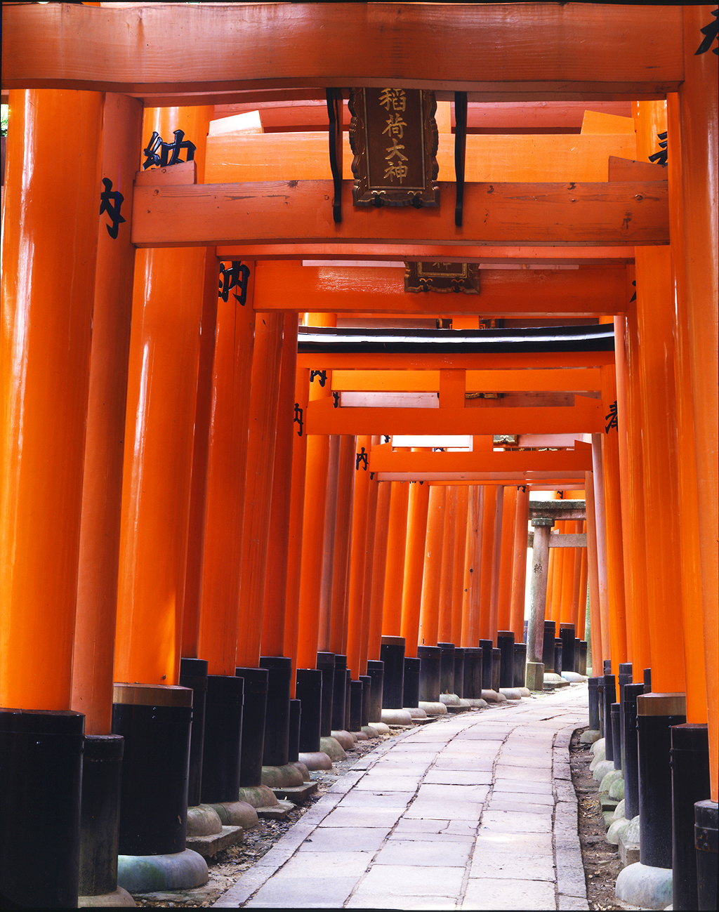
Fushimi Inari is not one tunnel of red gates. The entire 233-meter Inariyama is sacred ground, with the main shrine below and smaller shrines, worship stones, gates, and forest paths climbing above it. Decide how far you want to walk before the first photograph; that one choice determines whether this is a short stop or one of Kyoto’s most memorable hikes.
CHOOSE BY DISTANCE, NOT THE PHOTOGRAPH
Turn around after the famous gates, or enter through the forest with a guide?
MAIN SHRINE + SENBON TORII
I want the iconic visit with my own turnaround point
Stay flexible and stop at Okusha when the gates are enough, or continue only when the climb itself matters.
Follow the free shrine route
THREE-HOUR HIDDEN HIKE
I want bamboo, forest paths, smaller shrines, and their story
Choose roughly 7 km of real hiking when the quiet approach matters more than a quick torii photograph.
Check your date and current priceIncludes uphill and unpaved ground. Severe weather can move the tour onto the main shrine route.Still choosing your Kyoto day? Compare shrines, temple streets, food, tea, and bamboo in the complete Kyoto guide.
What the two options mean
Keep the morning flexible: Visit the Romon, main shrine, Senbon Torii, and Okusha, then choose your own turnaround point. JR Inari Station is beside the approach, and the shrine’s official mountain map shows what continuing uphill adds.
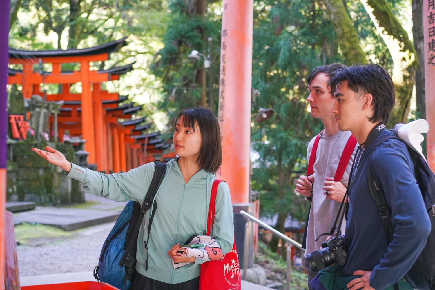
Enter through the forest: The listed three-hour route begins near Tofukuji and approaches through bamboo, forest paths, and smaller shrines before descending through the familiar torii. Expect uphill and unpaved ground; severe weather can move the tour onto the main shrine route. Its product photo and booking button appear once in the opening choice.
Pick the visit that matches your legs and day
Best for limited mobility, tight schedules, or travelers continuing to Kiyomizu and Gion. See the Romon and Honden without turning the visit into a climb.
The strongest first-time compromise: the gate tunnels and a deeper shrine atmosphere without committing to the full mountain.
Choose it for the sacred mountain, smaller worship sites, and physical rhythm. The summit is 233 meters above sea level, but repeated steps make the effort larger than the number suggests.
Choose it when avoiding the main approach at the start, reading the religious landscape, and walking through bamboo and forest are the product you want.
Access, time, crowds, rain, food, and shopping
Access
From Kyoto Station, Kyoto City recommends the JR Nara Line to JR Inari Station; the main approach is immediately outside. From Gion-Shijo, use the Keihan line to Fushimi-Inari Station and walk about five minutes. The shrine asks visitors to use public transport because nearby parking is crowded.
Time and crowds
Go early for the main route or check Kyoto City’s live congestion forecast before leaving. The city specifically warns of heavy crowding around Fushimi Inari. If the first gate tunnels are full, keep moving calmly; the mountain spreads visitors as the route rises.
Rain and heat
Rain can make stone, steps, and unpaved hidden trails slippery. Shorten to the main shrine and Okusha when footing or visibility becomes poor. The tour listing says severe weather may move the hidden hike onto the main sightseeing route for safety. In heat, carry water and remove the summit rather than rushing.
Food
Treat the shrine and the approach as separate chapters. Finish worship first, then eat in the temple-town streets near Keihan Fushimi-Inari Station. For a longer food afternoon, return by rail toward Nishiki Market rather than building snack stops into the climb.
Shopping
Fox motifs and torii souvenirs make sense here, but choose one object tied to the shrine’s meaning. For broader shopping, the central Fushimi district has local shopping streets and sake culture; it is a different stop from the mountain and should not be added automatically.
Read the shrine, not only the gates
Fushimi Inari Taisha is the head shrine of Inari shrines across Japan. The official shrine says people have prayed here since 711 for harvests, business prosperity, family safety, and other wishes. Foxes are messengers of Inari; keys shown in their mouths refer to granaries. The gates are part of a living place of worship, not a tunnel built for photographs.
Read the shrine's official history and worship guide
Before you reserve the hidden hike
- Expect about 7 km and uphill ground. This is a hike, not a flat photo walk.
- Wear sturdy walking shoes and carry water. Long sleeves and weather protection are sensible for forest paths.
- The route can change in severe weather. The operator may use the main shrine route instead of the hidden trail.
- Confirm meeting and end points on your live date. The provider describes a start near Tofukuji and finish around the main shrine area.
- Check private versus group option, accessibility, and cancellation before payment. The selected option controls the final conditions.
Sources and notes
- Fushimi Inari Taisha official site, accessed 2026-09-07. Shrine history, prayers, sacred mountain, map, and worship context.
- Official mountain map, Fushimi Inari Taisha, accessed 2026-09-07. Romon, Honden, Senbon Torii, Okusha, peaks, and mountain sites.
- Official access, Fushimi Inari Taisha, accessed 2026-09-07. JR, Keihan, bus, parking, and public-transport guidance.
- Kyoto City access guide, accessed 2026-09-07. Rail choices and travel times.
- Kyoto City destination guide, accessed 2026-09-07. Torii, mountain, fox, and contextual image.
- Fushimi Inari Hidden Hiking Tour, Viator, accessed 2026-09-07. Duration, language, rating, reviews, recommendation, route, effort, weather condition, and supplier.
- Provider product page, MagicalTrip Inc., accessed 2026-09-07. Exact-product image, approximate 7 km route, meeting and hiking preparation.
- Product route, option, price, availability, meeting point, accessibility, weather handling, and cancellation can change. Confirm them on the live listing.